

Do you ever wonder how a place got its name, or when or why something appeared in the landscape? Certainly most of us who have some sort of connection with May Hill have mulled over how the hill got its name, and how long has their been a distinctive clump of trees at the summit. As with many such questions the origins are now lost in time, and we cannot find definitive answers. For some this is probably a source of frustration, however in a world where there is increasingly an answer for everything (when I was young we had Loch Ness monsters, yetis , paranormal activities, ufos) it is reassuring that there are still some mysteries .
Anyway, I put the following timeline together for a short talk I gave to the May Hill Society this Autumn and hope some of you may find it of interest. I am grateful to Lesley Harding who is now putting the finishing touches to an Historic Landscape Assessment of the of the hill. Lesley has been researching and writing the report for us as a volunteer for the last couple of years.
MAY HILL – ITS NAME AND TREES
1240 – First reference to May Hill as Yartleton
1275 – Referred to as Larclesduna
1610 – Speed’s Map, shows Yortleton Hill as a prominent feature. But does not indicate the clump of trees, but the scale is very small.
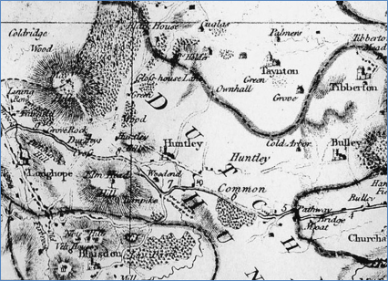
1619 – Document detailing the Custom of Pauntley Manor. Indicates that May Hill was used as a beacon as early as the early 17th century. ‘The tenants of the manor are usually called to do their services, to muster, and to show the armour and weapons to Deane, Newnham, Huntley, and other places…..and are appointed to watch and ward at a Beacon upon Yartleton Hill.
1695 – Robert Moreland Map of Glos. marks Yartleton Hill but doesn’t indicate any trees.
1717 – By this date the hill was also known as May Hill. A map of this date doesn’t indicate any trees.
1751 – Referred to as “Yattelton Hill, Glos on the S side of Newent” in England’s Gazeteer, Stephen Whatley. Still included as Yatteldon in the third edition, 1790, Philip Luckombe.
1777 – Isaac Taylor’s map of Gloucestershire is marked as May Hill, and with some imagination possibly shows the trees.
1779 – Rudder (A new History of Gloucestershire). “Annualy on the first day of May, there is a custome of assembling in bodies on top of the hill, from several parishes, to fight for possession of it, upon which account it metimes called May Hill.”
The fight (according to the Victoria History of the County of Gloucestershire) is suggested to have originated as a mock battle for possession of the hill, between the forces of winter and spring.
1770s – Spencer noted that May Hill was even then “…famous for the resort of Maurice dancers”.
1792 – James Baker’s Picturesque Guide through Wales – “Near this way (the road from Gloucester to Ross) is an engaging object (May Hill) to a great distance of county around it. It is distinguished from others in the neighbourhood by its conic form arising majestically above them, from its sides being dressed with the rarest native ornaments and having on its brow a flourishing crest of exotic firs.” He describes the May Day games as simply merry-making – May Hill is supposed to derive its name from a custom immemorable amonst the youthful villagers in its vicinity, to collect and revel out their assignations of innocent and seasonable recreations.
Of course there is the story that an Admiral May planted the first clump to act as a navigational aid for ships on the Severn
1800 – A circular plantation at the summit is said to appear in an engraving of c.1800 of Thomas Foley of Newent.
1805 Traveller’s Guide: or English Itinerary, Walley Chamberlain Walton. Included as “Yattelton Hill, (Glos) near Newent S.” But also included as “May Hill, or Yartleton Hill, (Glos) dist from London 112m 2f. It derived its name from an annual custom of the people of the several parishes, assembling every May-day on the top of the hill to fight for possession of it”.
1806 – Heath refers to the hill as being crowned with firs.
1807 – Fosbrook seems to contradict Heath. The firs on May Hill were by 1807 “cut down some years back”. If this is referring to sometime before then it could imply that there had been an even earlier clump of trees. “There was a mock battle for possession of the hill between youths in “winter livery and spring livery”, with spring always being victorious and carrying home the branches of the May Flowers.
It has also been suggested that the games could have had something to do with the allocation of common land.
It is also possible that there could be links with the pagan festival of Beltane, traditionally held at the beginning of May.
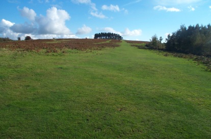
1820 – Rev. F.E. Witts? In his Diary of a Cotswold Parson, describes May Hill, a conspicuous round topped hill distinguished by a plantation on the summit.
1841 – The Tithe Map of 1841 shows the “Firs”
Undated snippet from newspaper “May Hill Memories” – “Memories recalled by the “Gloucester Journal” front page picture of May Hill prompted Mr Edmund Shirley Bliss. 113, Oxford Road, Gloucester, who is 83 years of age, to bring me a photograph of the top of the hill taken 56 years ago. Instead of the famous clump of trees which now adorn the summit, the photograph shows only four small trees”. Could have been CP Ackers Memories
- Drovers tracks are said to have been marked with groups of Scots Pines to show where cattle could stop for the night, which could offer an interpretation for why they were planted.
- No map or documentary evidence of drovers roads on May Hill and has been walked by an expert. Cattle were being driven through Newent from Wales from the C13. Expert suggested the trees may have been planted as a navigational aid. Commoners elsewhere weren’t keen on sharing their keep.
1874 At enclosure (when the top of the hill ceased to be commonland) an area of 4 acres on the summit was awarded to Longhope Parish Council for recreational purposes, delineated by a slight bank and ditch, and an access track was laid to provided access from Longhope to the summit.
1883 Particulars for the sale of the Huntley Estate – Summit was said to be planted with Scotch Firs and the owner was required to fence the recreation ground and the tracks leading to it. Although later documents suggest that the recreation ground was fenced against stock (there are references to the fences being damaged in 1901), there is no evidence that the tracks were ever fenced.
1887 Gloucester Journal February. “A popular proposal has just been made at the village of Longhope, Forest of Dean, to commemorate the Queen’s jubilee. Some 12 or more years ago the Enclosure Commission divided May Hill, which is about 1,000 feet above sea level, among the freeholders of the Parish. Four acres, however, were set apart as a public recreation ground. Formerly the crown of the hill was covered with hundreds of Scotch Firs, of which only about 80 are now left, and these are in a more or less advanced state of decay. This is felt to be a calamity, as the trees could be seen at great distances. The property is vested in the churchwardens of the parish, and the Messrs. T H Constance and S Chambers are engaged in promoting a fund for replanting the hill with trees. It is calculated that about £150 will be required. Already there is every promise that the project will be successful.”
- Church wardens accounts, Gloucestershire Archives. “A conversation took place in regard to the young trees planted on May Hill summit. It is hoped to have the ground between then levelled, so that the growth of long, coarse grass may be, in some measure stopped.” This relates to a Sydney Chambers, who was a church warden, and whose relatives contacted me seeking further information.
1883-1909 Numerous references in the PC minutes to difficulties in getting the trees to grow.
1896 Serious damage to the firs was reported due to the making of fires by picnickers.
1899 Young trees had been destroyed by sheep. Another 11 trees dead by 1901.
1906 By this time more trees had died due to rabbit damage, others by water.
1911 John Masefield wrote his poem “The Everlasting Mercy”.
The ploughman patient on the hill
Forever then forever still
Ploughing the hill with steady yok
Of pine trees lightening struck and broke
I’ve marked the May Hill ploughman stay
There on the hill day after day
Driving the team against the sky
1930 Owner of May Hill, Captain A Pringle, published a prospectus for a proposed golf course and building estate on May Hill. He said that he had decided to devote the ‘dome’ area to the Royal and Ancient Game of Golf, whilst at the same time preserving the general public the privilege of access and enjoyment they have hereto enjoyed.
1935 The National Trust acquired 130 acres of land on the summit following a successful appeal to raise £3,000 for its purchase. Proposal to create an 18 hole golf course put in details.
1971 There were 13 dead trees standing, several stumps and a very large and handy fallen scots pine for sitting on
1972 Further tree planting on the summit of the hill took place on the south side of the summit.
1977 Tree planting to commemorate the silver jubilee of QEII.
1980 Planting of a fourth section for the Queen Mother’s 80th birthday by a group of young offenders.
- Today – still many 19th century trees standing, and a single older Scots pine. Infected with red band needle blight. Whilst this will not kill them it makes them vulnerable to other forms of stress and disease and will speed their demise.
David Armstrong, Lead Ranger
